Rain, thunderstorms, wind, high surf and cold temperatures are descending on the Bay Area over the next few days as the first unsettled weather pattern of 2024 rolls over the region.
Tuesday's forecast from the National Weather Service calls for moderate to heavy rainfall with possible thunderstorm activity into Wednesday morning.
Rain totals are expected to run from about a half-inch to 1 inch at lower elevations and up to 2 inches for the coastal mountain ranges, and winds are expected to reach 20 mph to 30 mph along the coast and at higher elevations throughout the Bay Area.
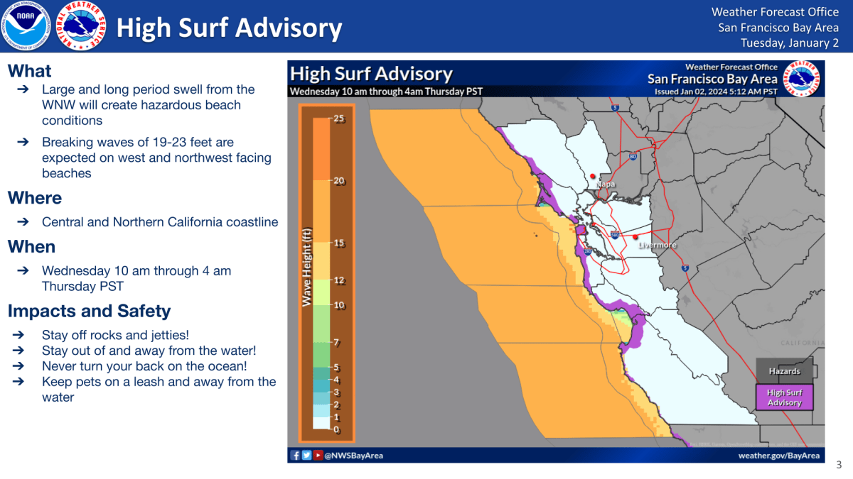
Also, as the rain moves through the region Wednesday morning, beachgoers can expect another period of hazardous surf conditions with waves cresting from between 19 feet to 23 feet.
Additional light rain chances are expected at the end of this week, when overnight temperatures are also expected to drop into the low-to-mid-30s in the North Bay, the East and South Bay inland valleys and inland areas of Monterey and San Benito counties, according to the weather service
